Although Tropical Storm Cindy was still being called “Potential Tropical Cyclone Three” early Tuesday, the oncoming weather system was expected to dump more rain on an already saturated Gulf Coast as it neared landfall in Louisiana.
The system is expected to move north to northwest and hit the Louisiana coast by late Wednesday, but forecasters say the low-pressure center’s impact will likely extend well to the east along the Gulf Coast, where a substantial amount of rainfall, which could cause flooding, is expected in parts of southeast Louisiana that are not directly in the storm’s path, as well as southern Alabama, southern Mississippi and the Florida Panhandle.
Emergency officials and others in Atmore, where rain has fallen nearly every day for two weeks, are keeping their fingers crossed, hoping for the best but preparing for the worst.
“We are monitoring the situation and are prepared to take steps as needed,” said an Atmore Police Department spokesman. “Preparations are in place to launch emergency operations if needed, and plans will be updated as needed.”
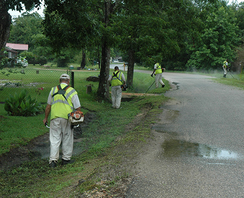
Calvin Grace, director of the city’s streets and sanitation department, said crews were already preparing for the extra precipitation.
“Basically, we’re making sure all the drains are open and all the waterways are cleared,” he said mid-morning Tuesday. “We have crews out today, all over town, making sure that those two things are done.”
According to The Weather Channel, “Potential Tropical Cyclone Three” is already packing winds of 40 mph, but Air Force Reserve Hurricane Hunter aircraft were unable late Monday to find a well-defined center of circulation, which keeps it from being a named storm. If and when that center develops, the storm will be named Tropical Storm Cindy.
TWC forecasters also noted that strong wind shear (the change in wind direction and speed with height) in the region will keep the system on the weaker side.
With weaker storms, the center is not as important a factor. The heavy rainfall, though, is projected to have a widespread impact. Many areas are expected to receive 4-8 inches of rain, with up to a foot projected for some areas. The most torrential rain is likely to be to the east of the center of the storm, because these areas will see a prolonged period of onshore flow.
The potential for another deluge has local business owners worried, as recent rains have already breached downtown Atmore sidewalks and sent water into stores, shops and offices.
“We’re preparing our sump pumps and hoping for the best,” said Tom Tschida, chief of operations for Pride of Atmore, the group responsible for maintenance and renovation of the Strand Theatre on Atmore’s Main Street, where flooding has been a problem in the past. “We’ve sealed up the opening in the back wall, where the squirrel fan was, and we have a new, $15,000 roof that’s not supposed to leak, so we’ll see what happens.”
If Cindy forms, it will be one of two storms in the Atlantic, a rarity for June. Cindy joins Tropical Storm Bret, which formed on Monday. Bret’s anticipated impact on the area has not yet been determined.
