One of the most active storm systems spawned last week by Tropical Storm Cindy dumped buckets of rain on an already water-logged city and county but otherwise passed quietly over Atmore and through Escambia County last Wednesday, June 21.
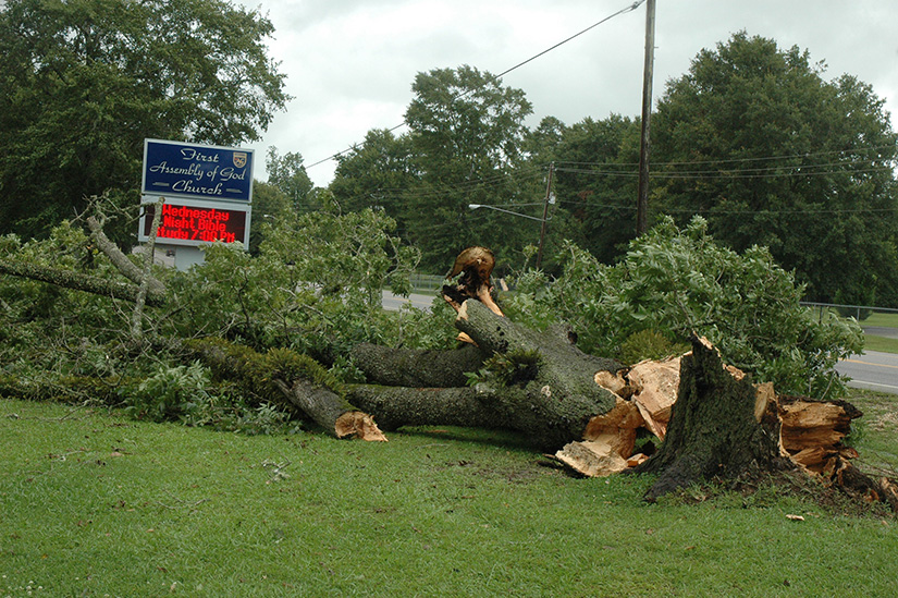
The series of thunderstorm cells, including the one that followed on Thursday, left relatively little structural damage in their wake as they moved through. But their cumulative effect was devastating to the community’s farmers, who can’t get into soggy and boggy fields to harvest the crops that were nearing maturity. Most vegetable or row crops remain at least partially submerged as the excess water continues to recede, days after the last of the rains fell here.
Jimmy McElhaney, a Bratt, Fla. peanut, corn and soybean farmer who also grows cotton on land near Robinsonville, said the majority of his crops are ruined or are in a state of near-ruin.
“I’m 67, and I’ve been farming most of my life, and I believe this is the worst June I’ve ever seen, as far as rain,” he said. “We can’t get into the fields to get our spring crops, and we can’t get in them to plant our summer crops. Even if we could, the planting season is about over. It’s not like a desk job, where if you get behind, you can catch up later. It’s now or never for us.”
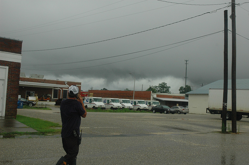
The most active of the Cindy-spawned storms moved into the county around 4 p.m. Wednesday and reached Atmore’s city limits almost immediately. Warning sirens were twice activated as dark spirals danced downward from rain-filled clouds that pushed 40-mph gusts ahead of them, but each potential twister was sucked back into the clouds just seconds after forming.
“It’s missed us,” Atmore Fire Chief Ron Peebles said around 4:15 p.m. as the whirling tempest cleared the city and moved northward over the Poarch Band of Creek Indians reservation and surrounding communities before it began to break up. “It definitely had at least one tornado in it, but they all stayed up in the clouds. And that’s fine by me.”
Peebles had watched the threatening weather system from the parking lot adjacent to the city’s main fire station, providing oral progress reports to other emergency personnel by radio. He said the storm’s swift exit from the Atmore area prevented his having to call in off-duty personnel.
An Escambia County deputy sheriff “chased” the swiftly moving squall line as it moved along Jack Springs Road. The county lawman reported at 4:53 p.m. that the threat to Escambia County had apparently ended.
The tropical storm, which made landfall Thursday morning between Cameron, La. and Port Arthur, Texas, was responsible for rainfall that ranged from 4.5 inches in the Tuscaloosa area to more than a foot in Mobile and some of its coastal neighbors. Unofficial reports from around Escambia County are that some areas were inundated with more than seven inches of rain, while most areas of the county got at least four.
According to The Weather Channel, Tropical Storm Cindy produced winds that moved with tropical-storm force as far as 250 miles inland from its center.
McElhaney said he would try and overlook the drowned or soured corn, peanuts and soybeans and chalk it up to part of the farmer’s lot.
“I hate to fuss when it rains so much, because we’ll miss that rain after everything dries out,” he said. “It’s just a case of God’s will be done; there’s nothing we can do about it.”

